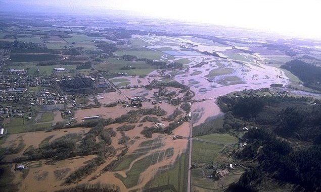
“Sauvie Island has a long history of flooding. The island is surrounded by the Columbia River and the Multnomah Channel. In 1844, the floodwaters reached as high as 33 feet, putting all but the highest points of land under water.
About 60 years ago, levees were built to protect the island from the Columbia River’s flooding. The areas outside the levees flood annually. You are looking at Sturgeon Lake. Sturgeon used to live in this water before the island was diked in the 1940s. After that, the lake began to fill in with mud, making it difficult for sturgeon to survive. Today, the mud is up to five feet deep and the sturgeon are no longer here.
In the winter, the floodwater often comes up as far as this post. In the flood of 1996, the water was 20 feet above the bottom of this post!”
From Oak Island Nature Trail Guide: George Middle School and ODFW